


About the Arboretum
About the Arboretum
A brief history
In March of 2013, the City of Bexley was accredited as an arboretum by the Morton Register of Arboreta, making it the first City in the United States to successfully obtain arboretum accreditation. In fact, trees have always been an important piece of Bexley’s community. For 35 years now the City of Bexley has been a participant in the Tree City USA program. Year over year great care and attention goes into maintaining over 14,000 trees within the City's right-of-ways and public parks. This commitmentment to trees is what makes Bexley Arboretum possible.
How did we become an official arboretum?
In 2013 we made history and became the country's first ever municipal arboretum registered by Morton Register of Arboreta. The entire city of Bexley is classified as an Arboretum. From our residential neighborhoods and schools to the commercial district and parks, each respective area reveres trees and contributes to our collective mission in unique ways. In order to qualify as an arboretum, The City of Bexley had to meet many requirements:
Develop a strategic master plan for our arboretum
A governing board or authority that is dedicated to the arboretum plan
Showcase a minimum of 100 species of trees/ woody plants with signage that identifies them taxonomically
A team of employees and volunteers dedicated to maintaining the arboretum
An arboretums collections policy
Enhanced educational programing for the public
At that time, our forestry department was already managing our local flora in such a way that the city only had to make a few adjustments to meet all the criteria to achieve Level II status.
Arboretum Facts
Arboretum Facts
39% canopy cover
57% of our municipal arboretum consists of green space
131 different tree species
6 designated parks
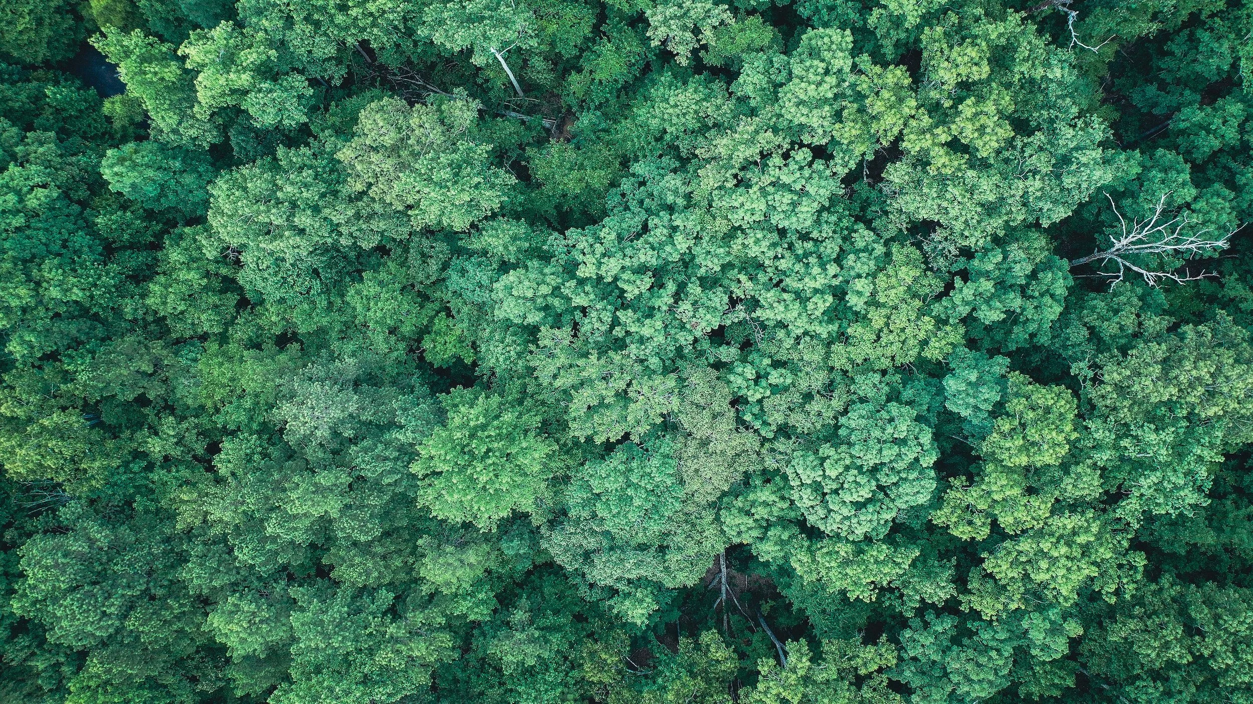
Canopy study
Canopy study
In 2021 The Bexley Arboretum contracted PlanIT GEO to conduct an intensive study of our arboretums tree canopy. This Urban Tree Canopy Assessment utilized advanced satellite imagery to interpret exactly how our green infrastructure is distributed. Our forestry department will apply this baseline knowledge to help us both make quick improvements to our overall canopy cover and land use as well as to set strategic, long-term goals for the future. Scroll through the document below to get a comprehensive view of the city’s current canopy distribution.
ADditional studies
Husqvarna Urban Green Space Index (HUGSI) is an AI satellite that analyzes the presence of green space and offers insight on how to improve green infrastructure in conjunction with urbanization. HUGSI shows Bexley Arboretum has more green space per capita than 95.2% of other US cities. Discover how Bexley compares to other cities around the world by viewing the Hugsi link below.
If you have inquaries regarding specific trees or streets, view the Bexley Arboretum Tree Inventory by clicking here.